Alex Cooke
Research
Maps & Tools
-
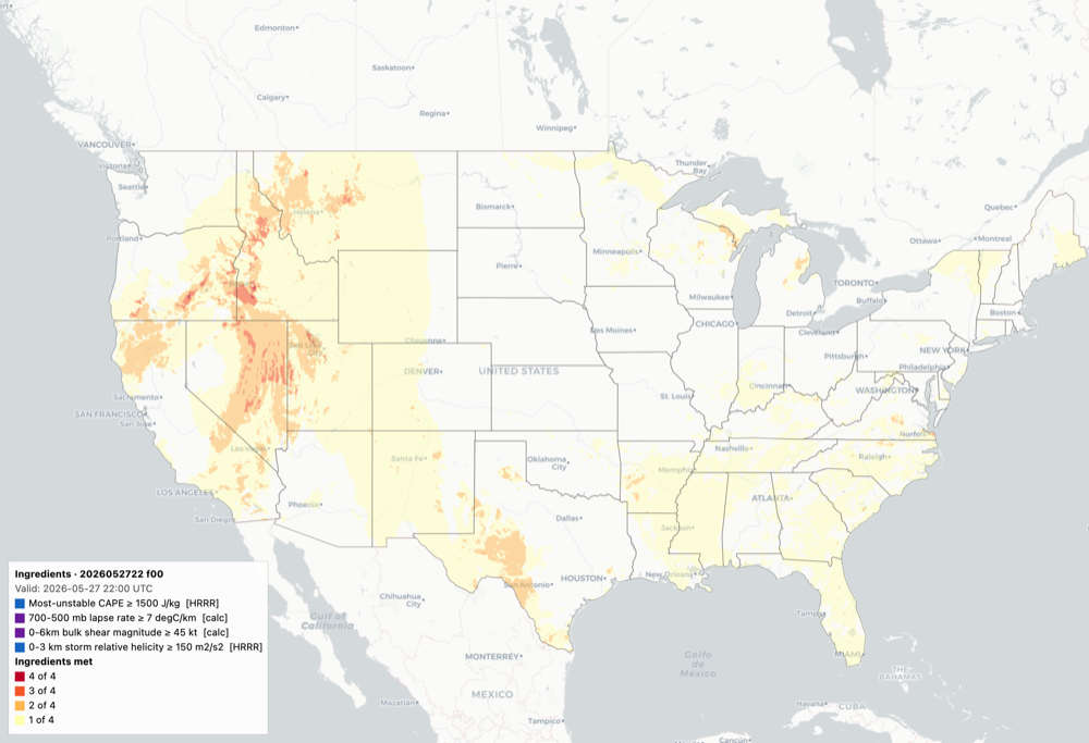 Interactive ToolHRRR Threshold ToolBuild joint threshold conditions across HRRR parameters and composites — CAPE, bulk shear, STP, ESRH, lapse rates, and more — then see where any N of your chosen “ingredients” are jointly met across the CONUS, hour by hour. Click any grid cell to see which conditions drove it. Built-in severe-weather presets, save/share your own, and PNG export. Updates hourly. Personal research project, not an official NWS/NOAA product.
 -
 Interactive ToolEFI / SOT CWA ViewerECMWF Extreme Forecast Index and Shift of Tails clipped to individual NWS forecast offices. Exact ESAT table values plus D3 Lambert Conformal map with contours, cities, and counties. Updates twice daily. Personal research project, not an official NWS/NOAA or ECMWF product.
 -
 Interactive ToolCAAST — AFD AnalogsConvective AFD Analog Semantic Tool. Finds historical Area Forecast Discussions with similar language to recent AFDs across all 122 NWS WFOs, then reports what severe weather followed. Hourly retrospective analysis using a fine-tuned sentence embedder over 5.2 million AFD sections (2004-2026). Personal research project, not an official NWS/NOAA product.
 -
 Interactive ToolDewpoint EFI / SOTGEFS Extreme Forecast Index and Shift of Tails for daily-maximum 2 m dewpoint, clipped to individual NWS forecast offices. The ensemble is scored against a 20-year reforecast climatology (2000-2019) for lead days 1 through 7. Updates twice daily. Personal research project, not an official NWS/NOAA product.
 -
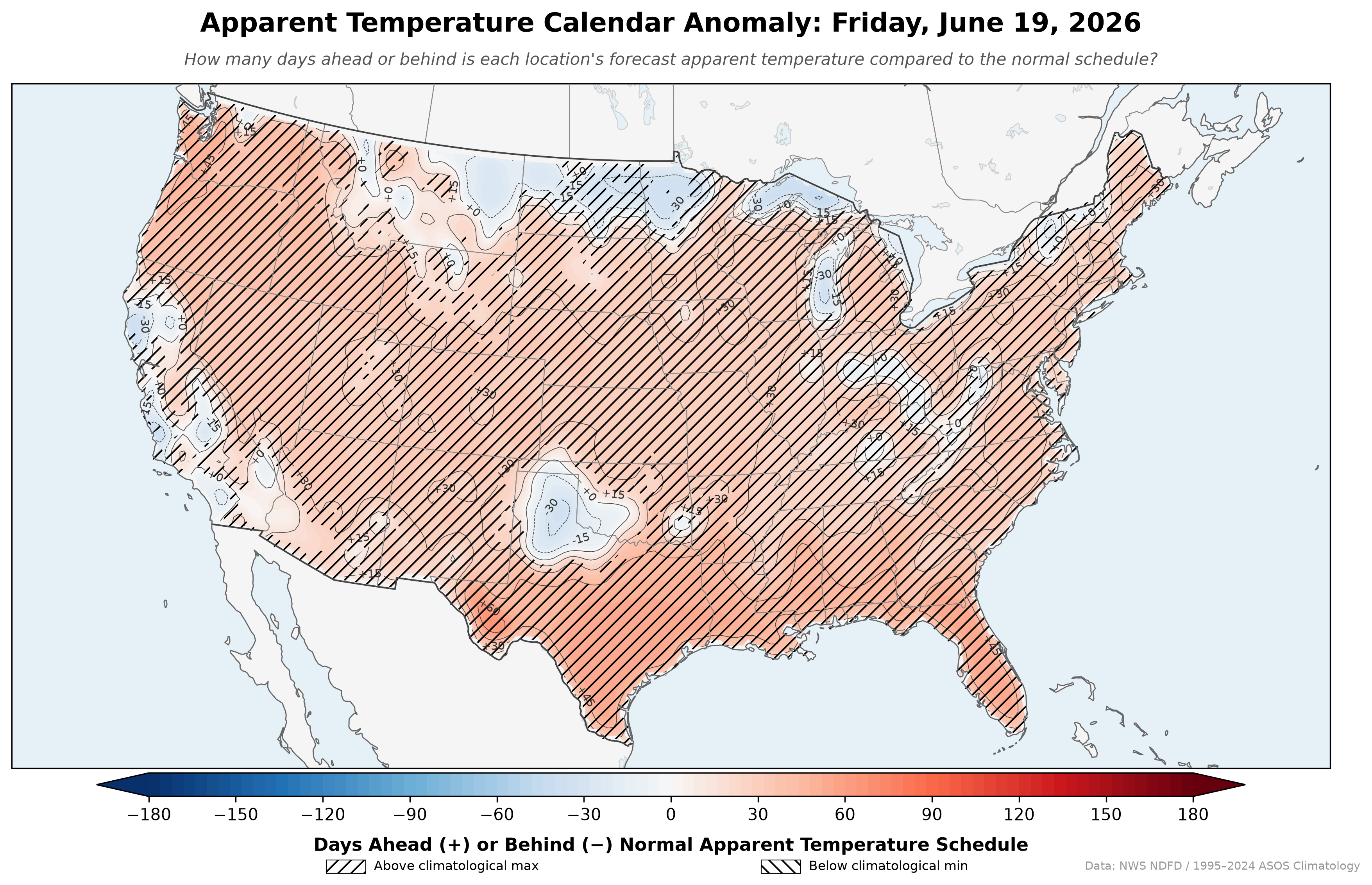 Daily MapApparent Temperature Calendar AnomalyHow many days ahead or behind the normal apparent temperature schedule is the forecast? Apparent temperature uses heat index when it's hot, wind chill when it's cold, and air temperature otherwise. Independent project, not an official NWS/NOAA product.
 -
 Daily MapTime Since TemperatureWhen was the last time this location was actually as hot — or as cold — as today's forecast? Each grid cell looks back through every observed daily max and min since 1979 and reports the most recent day that matched. Independent project, not an official NWS/NOAA product.
 -
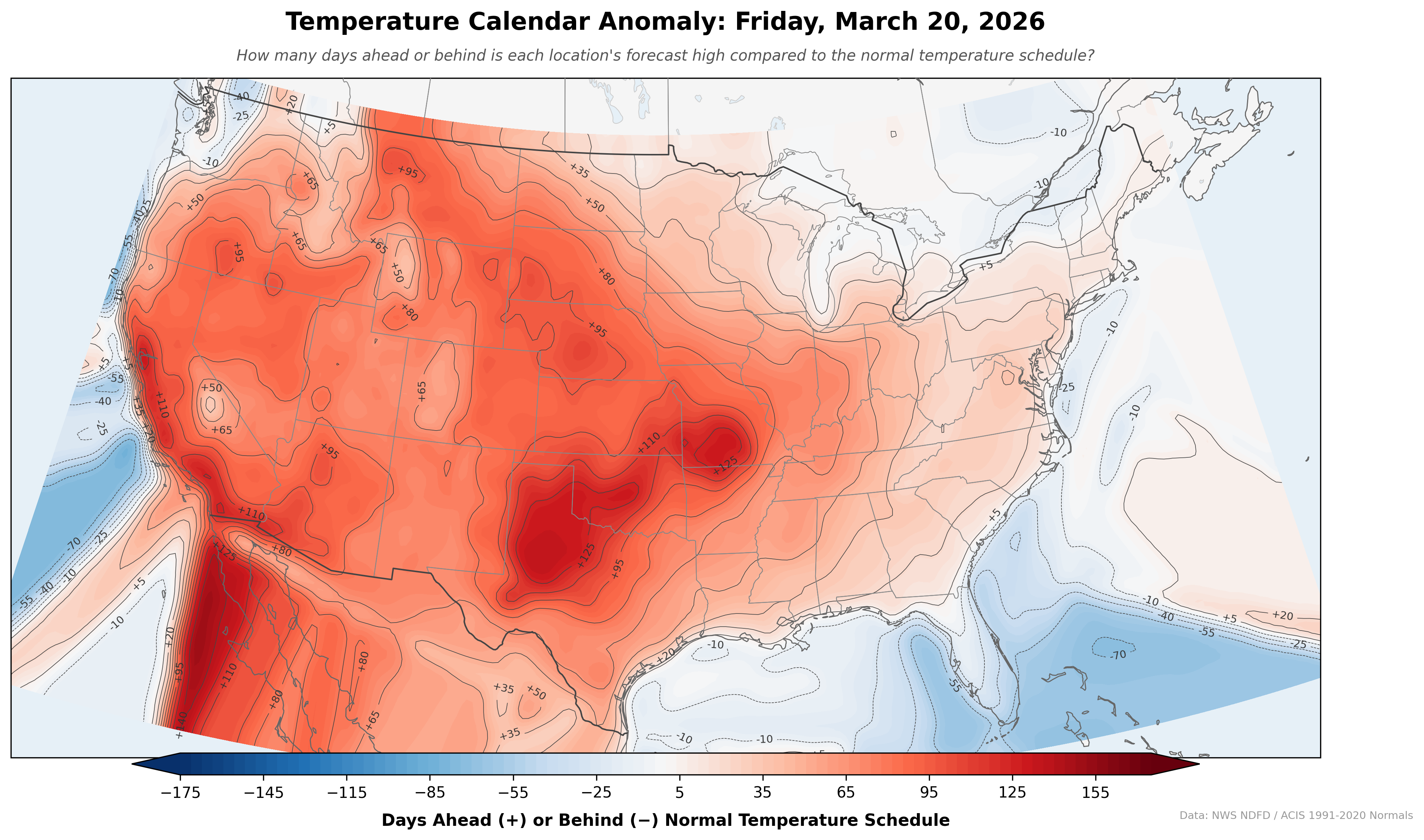 Daily MapTemperature Calendar AnomalyHow many days ahead or behind the normal temperature schedule is each part of the US? Independent project, not an official NWS/NOAA product.
 -
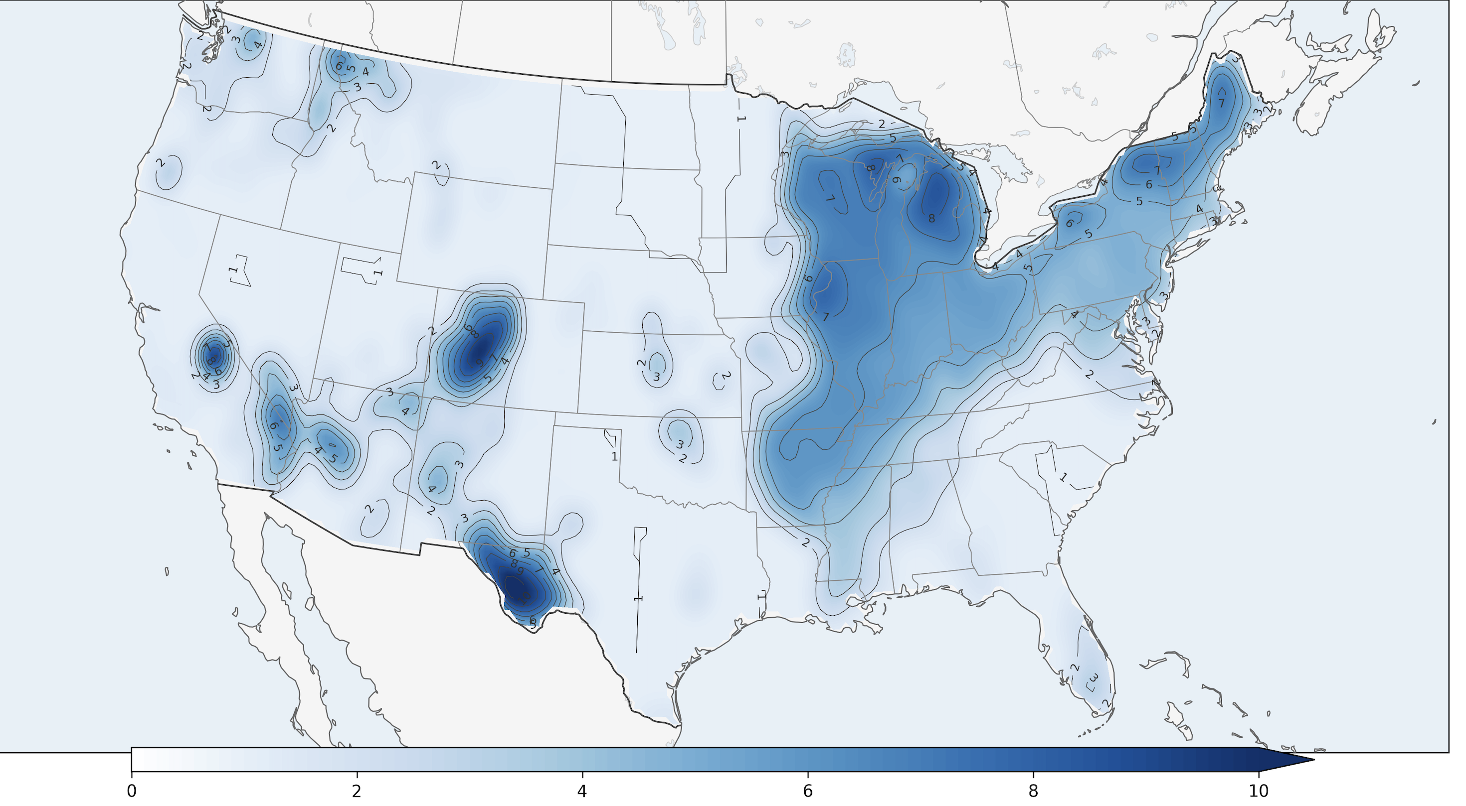
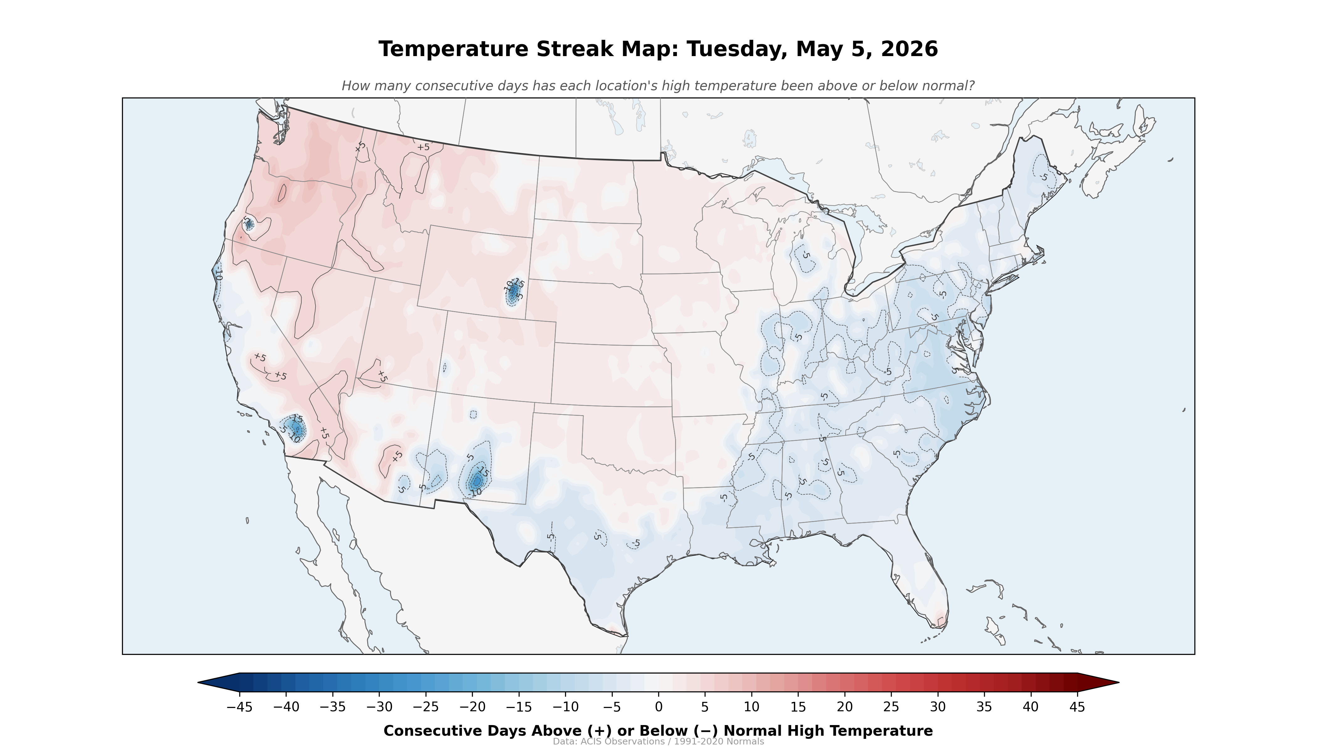 Daily MapTemperature Streak MapHow many consecutive days has each location been above or below its normal high temperature? Independent project, not an official NWS/NOAA product.
 -
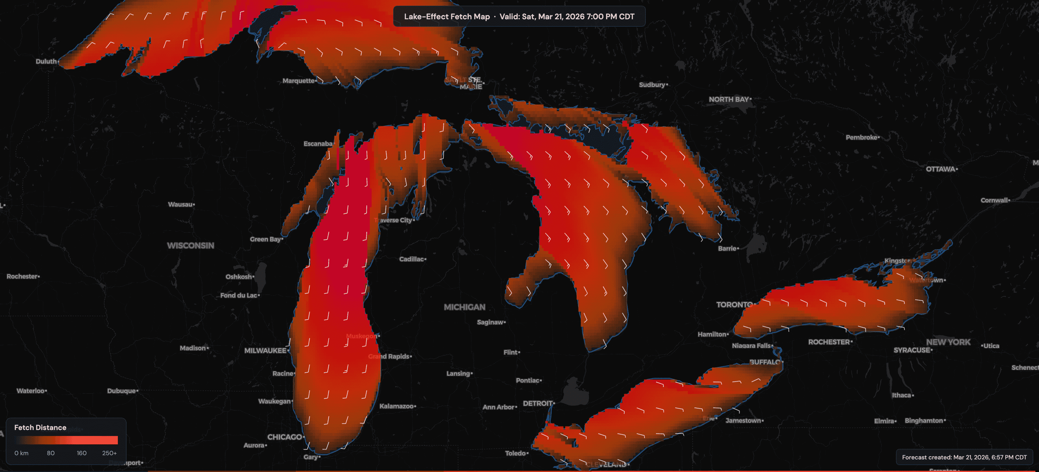 Interactive ToolGreat Lakes Lake-Effect Fetch MapReal-time fetch distance, residence time, and wind field visualization across all five Great Lakes. Includes wind barbs, SST, 850 mb temperature, and animated GIF export. Personal research project, not an official NWS, NOAA, or ECCC product. Wind data: NWS API + ECCC HRDPS. SST: GLERL climatology.
 -
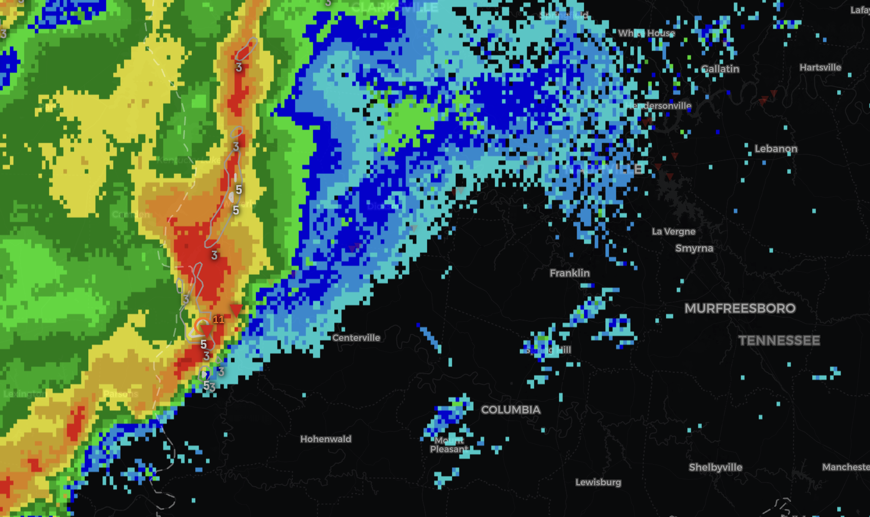 Interactive ToolTennessee QLCS Tornado DetectionReal-time QLCS tornado environment scoring for the Nashville CWA. MRMS radar with azimuthal shear overlays and HRRR-derived 0–10 environment score updated every 30 seconds. Includes historical case replay for 13 verified events. Personal research project, not an official NWS/NOAA product.
 -
Interactive ToolCalifornia Traffic Cameras by ElevationCaltrans cameras sorted by elevation for monitoring snow levels and mountain pass conditions. Developed as part of my work at the NWS. Not an official NWS product.